Call Us 24/7


Turkmenistan is a fascinating country in Central Asia, renowned for its ancient Silk Road heritage, impressive archaeological sites, diverse natural landscapes and distinctive traditions. It shares borders with Kazakhstan, Uzbekistan, Afghanistan and Iran, while its western coast lies along the Caspian Sea.
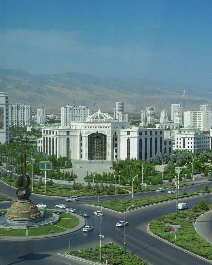
The capital, Ashgabat, is famous for its striking white-marble architecture, broad avenues, landscaped parks, fountains and monumental landmarks. Beyond the capital, travellers can explore the UNESCO-listed ancient cities of Merv, Kunya-Urgench and Nisa, which reflect Turkmenistan’s important role in the history of the Great Silk Road.
The country’s natural attractions include the vast Karakum Desert, dramatic canyons, mountain scenery, Caspian Sea beaches and the remarkable Darvaza Gas Crater. Turkmenistan is also celebrated for its world-famous Akhal-Teke horses, traditional handwoven carpets, national dress, music, cuisine and warm hospitality.
A journey through Turkmenistan offers visitors a unique combination of ancient history, authentic culture, extraordinary landscapes and modern architecture.
Ashgabat is the capital and largest city of Turkmenistan, as well as the country’s main cultural, scientific, administrative and economic centre. Over recent decades, the city has undergone remarkable development, gaining wide avenues, landscaped parks, monumental landmarks and numerous buildings clad in white marble. This distinctive architecture has earned Ashgabat the nickname “the White City.” On 25 May 2013, the city was recognised by Guinness World Records for having the world’s largest concentration of white-marble buildings. Landmarks of Ashgabat Ashgabat is renowned for its modern architectural landmarks, many of which symbolise the independence, neutrality and national identity of Turkmenistan. Among the city’s best-known attractions are Independence Park, the Monument of Neutrality, the 133-metre flagpole, the “Bagt Köşgi” Wedding Palace and the “Älem” Cultural and Entertainment Centre. The city is also home to several impressive mosques. Located near the centre, the Ertuğrul Gazi Mosque, also known as the Azadi Mosque, is distinguished by its elegant Ottoman-inspired architecture and bears a resemblance to Istanbul’s famous Blue Mosque. Approximately 11 kilometres from Ashgabat stands the monumental Türkmenbaşy Ruhy Mosque, known for its impressive scale, elaborate interior and striking white-marble architecture. Museums of Ashgabat Among the city’s most important cultural institutions are the State Museum of Turkmenistan and the National Carpet Museum. The State Museum of Turkmenistan houses more than 130,000 exhibits illustrating the country’s history from ancient times to the present day. Its collections include archaeological discoveries, works of art, historical documents, traditional carpets, national clothing and many other valuable artefacts. The National Carpet Museum is dedicated to the history and art of Turkmen carpet weaving. Its collection includes around 2,000 handmade carpets, among them one of the world’s largest handwoven carpets, covering an area of 301 square metres and recognised by Guinness World Records. Carpets hold a special place in Turkmen culture, and the country celebrates an annual national holiday devoted to this traditional art. Visitors can also explore the Museum of Fine Arts, the Museum of Wildlife and the “Ak Bugdaý” Museum, which presents the history of wheat cultivation and agricultural traditions in Turkmenistan.
Located in the southern part of Ashgabat, Independence Park is one of the capital’s largest and most important public parks. It is a major city landmark and an impressive architectural complex dedicated to Turkmenistan’s independence, national history and cultural heritage. The centrepiece of the park is the monumental Independence Monument. The surrounding grounds also feature the monument dedicated to the book “Ruhnama,” as well as bronze statues of prominent historical figures, poets, thinkers and national heroes who played an important role in the history of the Turkmen people. Independence Park covers approximately 140 hectares and stretches about 800 metres in width and 1,750 metres in length. Its spacious, beautifully landscaped grounds are filled with fountains, flower beds, walking paths and lush greenery. The park forms an important part of Ashgabat’s green urban landscape and offers visitors a peaceful setting in which to explore the history, culture and national symbols of Turkmenistan.
The Monument of Neutrality is one of Ashgabat’s most recognisable landmarks and an important symbol of modern Turkmenistan. It commemorates the country’s internationally recognised status of permanent neutrality. Rising to a height of 95 metres, the monumental structure is supported by three massive pylons symbolising stability and unity. Its upper section is crowned by a 12-metre golden statue of Turkmenistan’s first president, Saparmurat Niyazov. With its impressive scale, distinctive architecture and gleaming golden details, the Monument of Neutrality stands out prominently in Ashgabat’s cityscape. The surrounding landscaped grounds, fountains and green spaces make it an attractive destination for visitors and a significant part of the capital’s architectural heritage.
The Ertuğrul Gazi Mosque is one of the most beautiful and recognisable mosques in Turkmenistan. Located on Azadi Street in central Ashgabat, it is also commonly known as the Azadi Mosque. The mosque was designed in the Ottoman architectural style, enriched with elements inspired by Byzantine architecture. Its elegant domes, four slender minarets and refined decorative details give it a resemblance to Istanbul’s famous Blue Mosque. The idea of building the mosque was proposed by Turkish Prime Minister Süleyman Demirel during his visit to Turkmenistan in 1992. Construction began in early 1993, and the completed mosque opened its doors to worshippers in 1998. The mosque was named in honour of Ertuğrul Gazi, the father of Osman I, who founded the Ottoman dynasty. Today, the mosque is both an important place of worship and one of Ashgabat’s most impressive architectural landmarks.
Located in the village of Gypjak near Ashgabat, the Türkmenbaşy Ruhy Mosque is one of the largest mosques in Central Asia. Its monumental scale, white-marble architecture and richly decorated interior make it one of Turkmenistan’s most impressive religious and architectural landmarks. The main prayer hall can accommodate up to 10,000 worshippers at the same time: approximately 7,000 men and 3,000 women. A separate prayer area for women is located on the upper level. The mosque offers comfortable conditions throughout the year, with a powerful ventilation system regulating the indoor temperature and underfloor heating providing warmth during winter. The spacious prayer hall is decorated with an enormous carpet featuring an eight-pointed star associated with Oghuz Khan. The harmonious combination of traditional Turkmen motifs, modern engineering and monumental architecture gives the mosque its distinctive appearance and solemn atmosphere.
Kow-Ata Underground Lake is located near the town of Baharly, formerly known as Bäherden, at the foothills of the Kopet Dag Mountains, approximately 107 kilometres west of Ashgabat. The Turkmen name “Kow-Ata” means “Father of Caves.” At first sight, the cave resembles a magnificent underground hall. It is approximately 230 metres long, reaches a height of up to 20 metres and is as much as 57 metres wide in some places. The cave floor is covered with limestone formations, while the warm, gently bubbling water of the lake has a clear emerald colour. Even under artificial lighting, small stones can be seen at the bottom. As visitors approach the lake, the air gradually becomes warmer and more humid. Sounds resembling sighs or whispers can sometimes be heard overhead. They are produced by the large number of pigeons inhabiting the cave. The water temperature remains constant throughout the year, ranging between 33°C and 37°C. Chemical analysis has revealed that the water contains a complex combination of mineral and chemical elements, more than 30 of which have been identified to date.
Gökdepe, formerly known as Geok-Tepe, is a small town located approximately 45 kilometres northwest of Ashgabat. Although it may appear to be a quiet provincial town, it holds a special place in Turkmenistan’s history because of the decisive events that took place here in 1881. Today, the local population is mainly engaged in agriculture. The principal attractions of Gökdepe are the Saparmurat Hajji Mosque, the ruins of the historic Geok-Tepe Fortress and the National Museum of Gökdepe. The fortress was constructed within a short period and occupied an area of approximately one square kilometre. It measured about 1,450 by 670 metres, while its defensive walls stretched for nearly four kilometres. The walls reached a height of six to seven metres and were around eight metres thick at the base. In 1879, Russian troops launched their first major attempt to capture the fortress. The expedition numbered more than 7,000 men, including approximately 4,000 infantrymen, 2,000 cavalrymen and artillery units equipped with 16 guns. However, poor planning and an underestimation of the fortress’s defences led to the failure of the assault, forcing the troops to retreat. The fortress was eventually captured in January 1881 after another major siege. The Saparmurat Hajji Mosque was constructed between 1994 and 1995. It commemorates the defenders of the fortress and was also named in connection with the pilgrimage to Mecca undertaken by Turkmenistan’s first president. Despite appearing relatively modest from the outside, the mosque can accommodate up to 8,000 worshippers. It contains a large prayer hall for men and a separate women’s prayer area on the upper floor. Non-Muslim visitors may enter wearing the appropriate garments provided at the entrance. The National Museum of Gökdepe houses an impressive collection of historical artefacts and documents connected with the battle. Its exhibits include weapons, household objects, archival materials and paintings depicting the siege and the tragic events surrounding the fall of the fortress.
Nisa is an ancient city located approximately 15 kilometres west of Ashgabat. Today, only ruins and the remains of fortified walls survive, but around 2,000 years ago it was one of Central Asia’s most important centres of civilisation and, for a time, served as a capital of the Parthian Empire. Nisa consists of two fortified settlements—Old Nisa and New Nisa—situated approximately 1.5 kilometres apart. Following the fall of the Parthian Empire in 226 AD, the two settlements followed different historical paths. Archaeologists have discovered traces of the earliest settlements in the area dating back to the 4th millennium BC. By the 1st millennium BC, a sizeable settlement had developed there. Located at the northern foothills of the Kopet Dag Mountains, by the 4th century BC it had become a fortress protecting the northern frontiers of the Achaemenid Empire from nomadic tribes. When Alexander the Great passed through the region, Nisa became part of his empire. It was later incorporated into the Seleucid Empire before becoming one of the principal centres of Parthian civilisation.
The Seyit Jemalleddin Mosque is one of the few surviving medieval monuments in the vicinity of Ashgabat. Unfortunately, the devastating earthquake of 1948 destroyed most of the complex, leaving only sections of the walls, fragments of the entrance portal and part of the dome. Nevertheless, thousands of tourists visit the ruins each year. Although the surviving remains cannot fully convey the mosque’s former splendour, historians and archaeologists studied the monument in the early 20th century, when it was still largely intact. Their research allows us to form a clear picture of this masterpiece of medieval Eastern architecture. The mosque stood on a hill near the ancient settlement of Anau, approximately 12 kilometres from present-day Ashgabat. The architectural complex comprised the mosque itself, two additional buildings and the richly decorated tomb of Seyit Jemalleddin. Originally, the mosque had two minarets. Although they had disappeared by the 19th century, their foundations were discovered during early European expeditions. Built of fired brick and decorated with majolica mosaics, the mosque’s vivid entrance portal featured images of two yellow dragons—an unusual and unique element in the Islamic architecture of Central Asia.
High in the Kopet Dag Mountains, the village of Nokhur and the neighbouring settlements spread across the terraced slopes of mountain valleys are unlike anywhere else in Turkmenistan. The local Nokhurli people have preserved their conservative traditions, protected for centuries by the remoteness of their communities. They are known for their religious devotion, hard work and preference for marriage within their own community. Claiming descent from the army of Alexander the Great, the inhabitants of Nokhur point to a stone in the village that is said to bear the hoofprint of Alexander’s horse. The roofs of traditional Nokhur houses are supported by wooden columns that resemble the Ionic style. However, their design may have been inspired less by Hellenistic architecture than by the horns of local sheep. With its charming villages, magnificent landscapes and excellent opportunities for guided hiking, Nokhur is well worth exploring over several days. The cemetery on the eastern edge of Nokhur is particularly striking. Its carved wooden grave markers are decorated with ram horns. Visitors are requested not to enter the cemetery. A short distance farther on lies the pilgrimage site of Gyz Bibi. A thick-trunked plane tree surrounded by a small metal fence is covered with tiny pieces of cloth representing wishes and prayers. From the tree, concrete steps lead to a very narrow cave in the hillside. The cave is surrounded by numerous strips of cloth, some fashioned into tiny cradles—an indication of the nature of many wishes made here. This is one of several sites in Turkmenistan dedicated to Gyz Bibi. Legends describe her as a woman embodying great purity who was swallowed by a mountainside to protect her from pagan invaders or an unwanted marriage. Beyond Nokhur, the villages of Garawul and Könegümmez lie amid picturesque mountain scenery.
The ruins of the ancient city of Abiward lie eight kilometres west of Kaka, south of the road to Ashgabat, and are clearly visible from the highway. Abiward was once an important trading centre in northern Khorasan. It occupied a strategic position on the Silk Road between Nisa and Merv and also maintained connections with Nishapur, located to the south beyond the Kopet Dag Mountains. In the 9th century, the taxes collected in Abiward were almost twice as high as those levied in Serakhs, demonstrating the city’s considerable economic importance. However, Abiward appears never to have regained its former status after being sacked by the Mongols in 1221. At the height of its prosperity, Abiward possessed an advanced water-supply system, produced highly valued ceramics and minted its own coins. Today, the surviving ruins offer only a glimpse of the city’s former splendour. The eastern part of the complex contains a citadel surrounded by earthen ramparts, which are still crowned in some places by surviving sections of mud-brick walls. The entire site is encircled by a dry moat. To the west stand the crumbling clay walls of houses that were probably abandoned in the 18th century.
Just over 20 kilometres south of Kaka, near the village of Hywaabat, stands an 18th-century fortress built during the reign of Nadir Shah, the founder of Iran’s Afsharid dynasty. Situated in a picturesque setting at the foothills of the Kopet Dag Mountains, the fortress’s rectangular walls have retained much of their original structure. River erosion has destroyed most of the southern wall, but towers and crenellated walls survive elsewhere. Roads from the gateways in the northern and eastern walls lead to the remains of a large walled building in the centre of the complex. A 10-metre-high mound beside the northern wall offers an excellent view over the entire site. The fortress is also known as Old Hywaabat. According to legend, Nadir Shah was enslaved in Khiva during his youth and vowed that one day he would bring Khiva to his homeland. After becoming a powerful ruler, he conquered the city. It is said that he took thousands of people captive and ordered each of them to bring soil from Khiva. He then used this earth to build the fortress of Hywaabat near the Kopet Dag Mountains.
The Mausoleum of Meana Baba, commonly known simply as Meana Baba, is one of Turkmenistan’s most undeservedly overlooked historical sites. Its inconvenient distance from the main Ashgabat–Mary highway makes it difficult to include as a brief stop. Nevertheless, it is certainly worth making the detour. Abu Said was born in 967 in the town of Meýhene, which stood on the trade route between Abiward and Serakhs. His father was a herbalist and spice merchant, which enabled him to provide his son with an excellent education. Abu Said was renowned for his ascetic way of life. According to one account, he recited verses from the Quran while hanging upside down inside a well. After spending time in several cities, including Merv, Serakhs and Nishapur, Abu Said returned to Meýhene, where he died in 1049. By the time of his death, he had become a widely respected Sufi authority who played an important role in the political and spiritual life of the region. It is said that the Seljuk leaders Chaghri Beg and Tughril Beg sought his blessing for their campaign to overthrow the Ghaznavids. Some criticised his use of poetry, music and dance in his teachings, but he remained an immensely popular figure. According to legend, a piece of watermelon that accidentally fell from his feet was sold for 20 gold dinars. It is therefore unsurprising that a large mausoleum was erected at the place of his death. The mausoleum dates from the 11th century. It has a square base with sides measuring slightly more than 10 metres, above which rises a double dome—a characteristic feature of buildings constructed during this period by craftsmen from Serakhs. The transition from the walls to the dome is marked by four narrow niches alternating with four broader niches, each containing a small window. The entrance to the mausoleum is framed by a tall arched portal. An extensive 14th-century reconstruction introduced rich colours to the building. Particularly striking are the fine blue, turquoise and white mosaic tiles around the portal, arranged in geometric patterns and Arabic inscriptions. The interior paintings feature geometric and stylised floral designs on a white background, together with a recurring water-jug motif. The decoration inside the dome is arranged around a central eight-pointed star.
The main attraction of the Serakhs Historical Reserve, situated south of the modern town, is the 11th-century Mausoleum of Abul Fazl. Abul Fazl was a highly revered Sufi sheikh and the spiritual mentor of Abu Said of Meýhene. The mausoleum was erected over his grave shortly after his death in 1023. The building is a fine example of the architectural skill of the Serakhs craftsmen during the Seljuk period. Known locally as Serakhs Baba, the mausoleum consists of a square chamber with walls approximately 15 metres long, crowned by a double dome resting on a twelve-sided drum. The exterior walls, restored in the 1980s, each contain five niches with blind arches. Their decoration is created by alternating vertically and horizontally laid bricks. The tall portal, featuring a serrated ornament beneath the arch, dates from a 15th-century reconstruction undertaken during the Timurid period. Inside, the transition from the walls to the dome is formed by four curved sections separated by niches. At the centre of the chamber stands the cenotaph of Abul Fazl, covered with metal sheets. A steep spiral staircase leads to the roof of the mausoleum. From there, visitors can enjoy a good view of the surrounding area, including the citadel to the north. Handprints can be seen on some of the roof tiles; they may simply have been made to make the tiles easier to handle during installation. North of the mausoleum lies the citadel—a long, low mound covered with fragments of pottery and red brick. A section of the wall, including a bastion, has been reconstructed on the eastern side of the mound. During the city’s period of prosperity, the principal residential districts of Serakhs extended east of the citadel. They were surrounded by mud-brick walls, whose outlines can still be distinguished from the citadel’s observation point. Yarty Gumbez, meaning “Half-Dome,” is a somewhat misleading name, since nothing of the dome has survived. Another recent loss is an inscription formerly visible on the building’s eastern wall. Clearly shown in photographs taken here during the 1970s, the inscription dated the mausoleum to 1098.
Altyn Depe, meaning “Golden Hill,” is a settlement dating from the Chalcolithic and Bronze Ages. Extensive archaeological excavations were carried out here during the Soviet period. The settlement contains numerous indications of early urban development. These include a specialised pottery quarter where many ceramic objects and the remains of kilns were discovered; evidence that residential quarters were divided into districts according to the wealth and social status of their inhabitants; and signs of long-distance trade networks. The discovery of ivory objects, including gaming pieces, led some researchers to suggest that Altyn Depe had links with the Harappan civilisation of the Indus Valley. One of the site’s most significant discoveries was a monumental religious complex centred around a stepped ziggurat-like structure crowned by a small sanctuary. Among the objects found here were two that justify the name “Golden Hill”: a small golden wolf’s head and a larger golden bull’s head, measuring more than seven centimetres in height, with a turquoise crescent inlaid on its forehead. Russian archaeologist V. M. Masson suggested that the religious complex may have been dedicated to the Moon god, who was often associated with the image of a bull in Mesopotamian mythology. Altyn Depe was abandoned by the middle of the second millennium BCE, possibly because of the excessive exploitation of the surrounding land. Its inhabitants subsequently migrated eastwards to the Merv oasis.
Namazga Depe, the largest proto-urban settlement in southern Turkmenistan, was continuously inhabited from the late fifth millennium until the second millennium BCE. It is remarkable not only for its size but also for the level of cultural development achieved here during the Bronze Age. This is reflected in its fine pottery, advanced metallurgy and urban planning, characterised by multi-room dwellings with adjoining open courtyards separated by narrow streets. The site consists of a large, irregularly shaped mound reaching approximately 20 metres in height and covering an area of about 70 hectares. A considerable part of the site is occupied by a cemetery, whose association with holiness is reflected in the name Namazga, derived from namaz, meaning “prayer.” The cemetery was originally used by the inhabitants of Abiward, located only a few kilometres to the north, beyond the railway tracks, and clearly visible from the summit of Namazga Depe. The presence of the cemetery has restricted archaeological investigation across much of the site. The most promising area for research is the highest part of the mound, situated in its north-western corner, farthest from the cemetery. This area is known as the “bastion.” Its height was formed by the remains of later settlements and apparently represents traces of habitation that survived the period of cultural decline during the second millennium BCE. Rectangular kilns can still be distinguished here. A small mound near the turn-off leading to Namazga Depe is known as Tekkem Depe. It was excavated by Soviet archaeologists during the 1980s and is worth visiting on the return journey from its larger neighbour, as several mud-brick walls were uncovered there. Tekkem Depe appears to have been a satellite village of Namazga Depe.
Ulug Depe is one of the early agricultural settlements in the fertile belt at the foothills of the Kopet Dag Mountains. By the beginning of the Bronze Age, it had developed into a flourishing settlement. Although smaller and less significant than proto-urban centres such as Altyn Depe, Ulug Depe is now one of the region’s most interesting ancient sites for visitors. This is largely because it remains the subject of an ongoing research programme led by French archaeologist Olivier Lecomte. French excavations have uncovered a fortified mud-brick building dating from the Late Iron Age. Its surviving features include a buttressed outer wall and a paved corridor. The information plaque at the site reveals little about its historical significance. It merely informs visitors that Ulug Depe is an important historical monument and that grazing livestock and leaving litter within its territory are prohibited.
The Mausoleum of Zengi Baba is a heavily restored square-based structure crowned by a dome. The transition between the walls and the dome is marked by four niches separated by recessed sections. Researchers believe that the mausoleum either dates from the thirteenth or fourteenth century, when it was built using bricks taken from earlier structures, or was originally constructed in the tenth or eleventh century and then rebuilt two or three centuries later. The cenotaph is decorated with tiles bearing geometric patterns. Outside the mausoleum lies a pile of objects popularly described as fossilised dinosaur eggs—or perhaps cannonballs. Ammonites and other stones are also gathered here. Their unusual appearance has led people to attribute sacred properties to them. The mausoleum at Murche is the best known of several mausoleums in Turkmenistan dedicated to Zengi Baba, the patron saint of cattle breeders. Turkmen traditions associated with Zengi Baba combine Islamic beliefs with distinctly pre-Islamic elements, including the Zoroastrian veneration of livestock. Many popular Turkmen legends describe a rivalry between Zengi Baba and Duldul Ata, the patron saint of horse breeders. One such story tells of a race resembling the tale of the hare and the tortoise, in which horses competed against cows to be the first to return to the village. The cunning Zengi Baba prayed for rain, which turned the ground into thick mud. This hindered the horses but not the cows. He also summoned enormous clouds of mosquitoes, which tormented the horses but failed to stop his cows as they steadily advanced towards the village. Thus, the cows became the unexpected winners of the race.
Merv is one of the oldest known cities in Central Asia, with a history spanning more than 4,000 years. It is situated on the banks of the Murghab River. The city was repeatedly destroyed and rebuilt, serving as the capital of various states. By the twelfth century, it had become the largest city in the world, with a population of around half a million. Although the reasons for its eventual abandonment remain unclear, Merv today comprises an extensive landscape of ancient ruins and unique medieval monuments. It is located in eastern Turkmenistan, approximately 30 kilometres east of the city of Mary. With its wide range of accommodation, restaurants and an airport, Mary is an ideal base for travellers wishing to explore Merv. Most visitors stay in Mary and take day trips to the ancient city. Merv lies approximately 330 kilometres from Ashgabat, the capital of Turkmenistan. Mary can be reached by car or plane. The journey from Turkmenabat is similar: Merv is about 200 kilometres away, across the vast Karakum Desert. A paved road passes through the ruins, making it convenient to explore the site by car. The first settlement in the Merv oasis appeared around the turn of the fourth and third millennia BCE. It belonged to the Bronze Age Margian civilisation, which existed at the same time as the ancient Babylonian kingdom. Over time, the settlement developed into a fully established city. In the fourth century BCE, a Margian fortress called Alexandria was built nearby by order of Alexander the Great. In the first century CE, an expedition led by the Chinese general Ban Chao reached Merv. By the third century, a Christian community had already formed in the city. Merv became a multicultural and multi-religious centre on the southern branch of the Great Silk Road, with trade routes extending towards Iran, Afghanistan and India. In the seventh century, the city was conquered by the Arabs and became an important cultural and scientific centre of the Arab world in Central Asia. By the twelfth century, Merv had reached the height of its prosperity as the capital of the Seljuk Empire. One of the most significant monuments from this period is the monumental Mausoleum of Sultan Sanjar, ruler of this powerful empire. Historians estimate that Merv’s population at the time exceeded 500,000, making it the largest city in the world. At the beginning of the thirteenth century, however, Merv was destroyed by the army of Genghis Khan and remained largely abandoned for almost 200 years. The Mongols destroyed not only its fortifications and residential districts but also the irrigation system along the Murghab River. Although the city and its network of canals were restored in the early sixteenth century, Merv never regained its former importance. It passed between several powerful kingdoms until the middle of the nineteenth century, when it was handed over to the Turkmens, who surrendered it to the Russian colonial army in 1884. The city gradually declined, while a new settlement grew 30 kilometres to the west. It too was called Merv until 1937, when it was renamed Mary. The historical monuments of Merv are spread across an extensive area covering more than 15 square kilometres. They can be divided into two principal categories: fortress ruins and mausoleums. Erk Kala. A circular fortress dating from the sixth century BCE, with weathered walls resembling a meteorite crater. Gyaur Kala. A massive fortress dating from the third century BCE, covering more than 300 hectares and built as an extension of Erk Kala. Greater and Lesser Kyz Kala. Two small fortresses dating from the eighth and ninth centuries that served as fortified estates for local feudal lords. Abdullah Khan Kala. The most recent of Merv’s fortresses, built in the fifteenth century to the south of the main group of historical monuments. Sultan Kala. A fortress representing the newer part of Merv, built during the eleventh and twelfth centuries and covering more than 400 hectares. Mausoleum of Yusuf Hamadani. The tomb of a renowned twelfth-century teacher and theologian whose disciples included Ahmad Yasawi. A new mausoleum was built in the nineteenth century. Mausoleum of Sultan Sanjar. A 38-metre-high monument dating from the twelfth century and one of Turkmenistan’s principal tourist landmarks. Mausoleum of the Askhabs. A fifteenth-century religious complex built over the tombs of companions of the Prophet Muhammad. Mausoleum of Muhammad ibn Zayd. A twelfth-century structure built over the tomb of a prominent figure in Shia Islam.
The main reason to visit Tagtabazar is the cave settlement of Ekedeshik, located among the sandstone hills north of the town. The name “Ekedeshik” means “single entrance.” The site is fascinating: more than 40 rooms open to visitors are arranged across two levels. Near the entrance, the caretaker lifts a metal plate set into the floor to reveal a steep staircase leading down to the lower levels, which are considered too dangerous to visit. From the entrance, a central vaulted passage rises gently and extends approximately 37 metres into the hillside. Doorways to small rooms open from both sides of the passage. Many contain circular “wells” located in small adjoining chambers. Niches cut into the walls once held candles. One room beside the main corridor appears to have belonged to a particularly distinguished resident or to have held a prestigious function: its entrance is crowned by a carved lintel, while its vaulted ceiling is decorated with rectangular carved panels. Reeds have been thoughtfully laid along the floor of the central corridor to prevent dust from accumulating. Captain F. de Laesso was among the first to map the caves. He published a sketch in an article that appeared in the Proceedings of the Royal Geographical Society in 1885. However, de Laesso’s exploration of the caves and ruins at Panjdeh was brought to a sudden and premature end by the advance of Russian troops. The identity of the cave builders remains the subject of debate. Some scholars believe they were constructed by early Christian communities, while others suggest that the complex may once have been a Buddhist monastery. The site is naturally associated with numerous local legends, including rumours of an underground passage leading all the way to Afghanistan.
Gobekly is an ancient settlement in the centre of the Merv Oasis, situated 32 kilometres north-west of Gyaur Kala. Its ground plan is square, measuring 88 × 88 metres, while its ruins rise 12–13 metres above the surrounding terrain. At the centre of the settlement stands a large building dating from the Parthian period—the House of the Ruler. Residential and ceremonial rooms occupied its central section, while a system of surrounding corridors was arranged around the perimeter. The entire complex was enclosed by fortified walls, with the gateway positioned in the middle of the southern wall. No traces of buildings around the fortress have survived. Gobekly Depe was first recorded by an American expedition to Turkestan in the early twentieth century. Archaeological investigations conducted by a joint Russian–Turkmen expedition led by G. A. Koshelenko and A. Gubaev during the 1980s and from 1997 to 2001 made it possible to identify four principal periods of occupation at the site.
Chilburj is an ancient fortress located 20 kilometres north-west of Merv. Its historical name remains unknown. The fortress has an irregular rectangular plan, measuring approximately 230–260 × 200 metres. Its walls are closely flanked by projecting rectangular towers containing casemates, while the corners are reinforced with massive bastions. Between the towers are passages built into the walls, with niches intended for archers. Both the towers and the connecting wall passages are densely covered with arrow-shaped loopholes, most of which are decorative rather than functional. Chilburj had two entrances—one in the north and another in the south—connected by a central street that crossed the settlement. Since it was originally built as a military fortress, its inner courtyard was not developed. Only the remains of an unidentified structure, where a fire was once kept burning, have survived in the centre. The fortress was founded during the Late Parthian period, in the second or third century AD. During the Late Sasanian period, from the fifth to the seventh century, Chilburj developed into a prosperous town with densely built-up shahristan and rabad quarters. Its growth was interrupted by the Arab invasion. The third stage of urban life dates from the High Middle Ages, between the tenth and twelfth centuries, when Chilburj served as a stopping place for caravans. In the tenth century, a small Friday mosque measuring 34 × 32 metres was constructed nearby. Chilburj continued to function as a caravanserai until the Mongol invasion, after which it was completely abandoned.
The Museum of Fine Arts of Ancient Merv houses a unique example of ancient art. It is a small fragment of a stone mosaic, no larger than the palm of a hand, discovered among hundreds of other fragments from mosaic panels that once decorated the royal tombs of Gonur Depe. The fragment depicts an expressive female profile, skilfully rendered with several black strokes along the carefully carved outline of the head and neck. Whose image is this, miraculously preserved to the present day after lying in Turkmen soil for more than 4,000 years? Was she an unknown goddess or a priestess of a local temple? Perhaps she was a princess who lived in the state of Margush? It is probably no coincidence that the fragment was found in a so-called royal tomb, where numerous other valuable objects used as funerary offerings were also discovered. Gonur Depe is the largest of all Bronze Age Margian settlements discovered in the northern part of the ancient delta of the Murghab River. Today, the site lies within the Garagum District of Mary Province. A large city once stood here, inhabited from the end of the third to the middle of the second millennium BC. Excavations were conducted under the direction of the renowned archaeologist Viktor Sarianidi, an honoured member of the Academy of Sciences of Turkmenistan. Through his work, the city became known throughout the world for its monumental architecture, which anticipated the fortresses, palaces and temples of later periods, as well as for numerous sensational discoveries that are now valuable exhibits in three museums of Turkmenistan. The mosaic compositions discovered in the underground tombs of Gonur during excavations in 2004 are of particular value. These mosaics decorated interiors and treasure chests that local nobles offered to their deceased. Like other followers of ancient polytheistic beliefs, they believed in an afterlife and considered it essential to offer the souls of the dead the most precious things they possessed. This was not limited to gold and silver household objects that had no practical purpose and served an exclusively ritual function. During lectures at our museum, Professor Sarianidi emphasised that the decoration of the walls and furnishings of royal tombs with such exquisite mosaic panels—examples of which were not found even in palaces or temples—demonstrated the great importance ancient people attached to the soul’s existence after death. The uniqueness of the Gonur mosaics has already been recognised by the academic world. Numerous scholarly articles have been devoted to the subject, yet much remains to be written, since the art of Bronze Age Turkmenistan is only now beginning to receive serious study. Historians maintain that nothing comparable has been found at any other monument of the same period anywhere in the Ancient East. Among the fragments discovered and subsequently carefully restored, several narrative and ornamental panels are preserved in our museum. The mosaics were created using a mixed technique, combining stone inlays with coloured painting. The images were produced with various pigments, including charcoal for black, ultramarine extracted from lapis lazuli for vivid blue, and cinnabar or red ochre for bright red. The most important details—including human and animal heads, bodies and limbs, as well as birds’ feathers and feet and recurring ornamental elements—were made of stone.
Kunya-Urgench, meaning “Old Urgench,” is an architectural reserve located 480 kilometres north of Ashgabat. It was the ancient capital of northern Khorezm and was mentioned in Chinese written sources as early as the first century AD. In the middle of the eighth century, the city came under Arab rule. In 995, Gurganj—the name by which the city became known after the Arab conquest—became the residence of the Khorezmshah and the second-largest city after Bukhara, the capital of the Samanid Empire. As a major cultural and commercial centre during the Middle Ages, the city was associated with Avicenna (Abu Ali ibn Sina), Al-Biruni, Ibn Battuta and other prominent scholars and travellers of the period. In 1221, the city, then regarded as one of the “hearts of Islam,” resisted Genghis Khan and was destroyed by the Mongols. After recovering from this devastation and regaining its former strength, Kunya-Urgench was once again destroyed by Mongol forces in 1388. This time, the destruction was ordered by Timur, who viewed the city as a rival to Samarkand. Following these events, Urgench fell into decline for many centuries. People returned to the area in 1831 during the construction of the Khan-Yab irrigation canal. Many of Kunya-Urgench’s magnificent monuments have survived to the present day, although several of them remain in a severely ruined condition. They are now among the site’s principal attractions.
The Darvaza Gas Crater is located in Turkmenistan, in the heart of the Karakum Desert—one of Asia’s greatest deserts. Imagine a crater 60 metres in diameter and 20 metres deep, blazing with hundreds of flames, roaring and releasing waves of scorching air. Natural gas escapes through pores in the ground and separates into hundreds of burning flames of various sizes. Some of them rise to a height of 10–15 metres. Local residents say that the fire glowing in the darkness draws thousands of living creatures into the flames. Many insects, birds and animals have been “hypnotised” by the light at night and disappeared into the fire. At first glance, the crater appears to be filled with molten lava. In reality, however, the origin of this spectacular sight is rather prosaic. In 1971, an exploratory gas well was drilled here and struck an underground cavity. The drilling rig, together with all its equipment and vehicles, collapsed into the abyss. Fortunately, no one was injured. Natural gas began escaping from the man-made crater. It was set alight to prevent the gas from poisoning people and livestock. Since that event, the flames have continued to burn for 35 years. No one knows how many millions of cubic metres of valuable natural resources have been consumed by the fire.
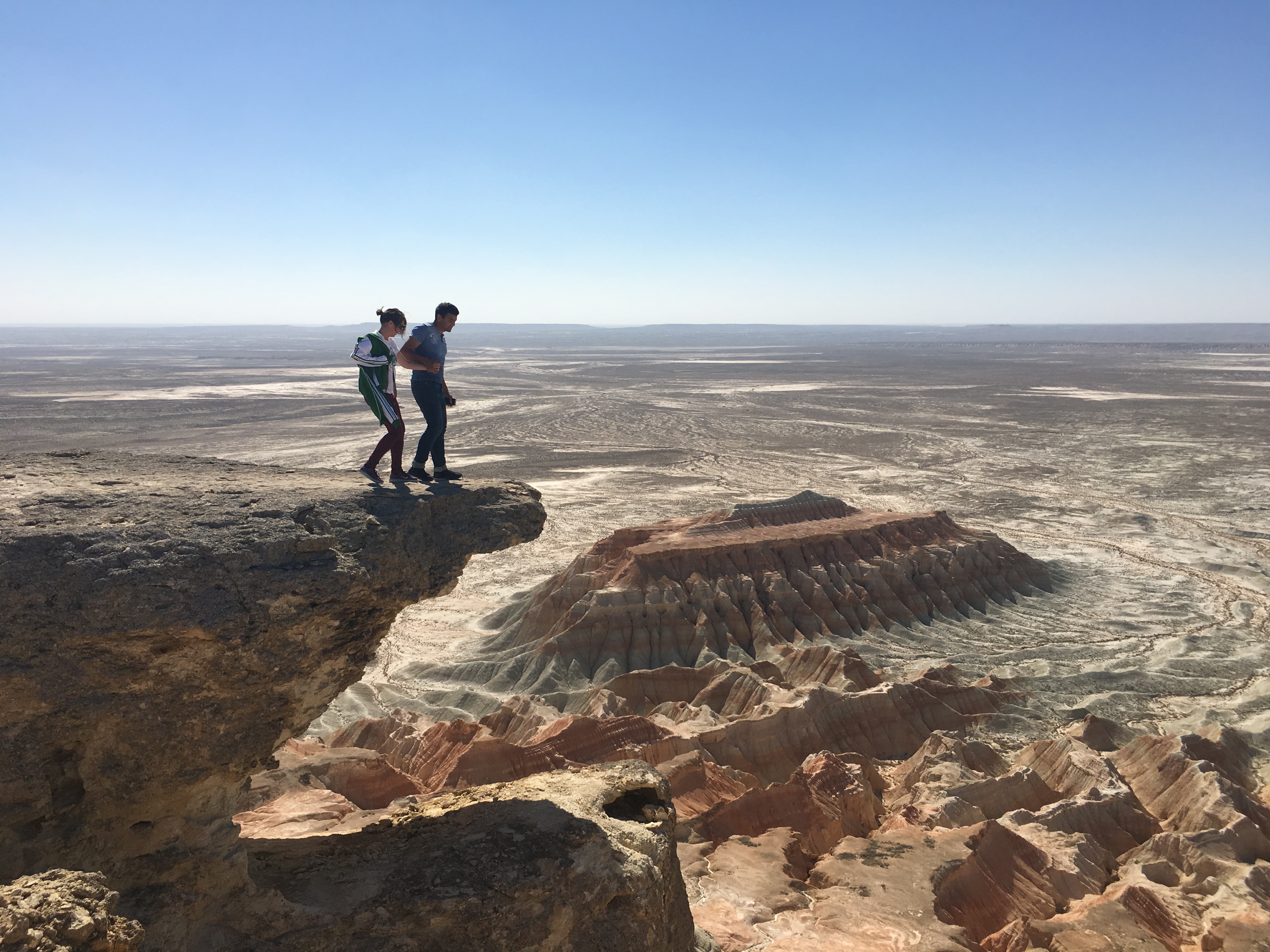
Yangykala Canyon, one of Turkmenistan’s most remarkable natural attractions, is located in the Balkan Region in the north-west of the country. The name “Yangykala” comes from the Turkmen language and means “fiery fortresses.” The canyons were given this name because of the predominantly red colour of the rocks that form their hills and cliffs. Similar mountains in China are also known as the “Flaming Mountains.” The canyons present an incredibly beautiful sight. After leaving Balkanabat and travelling across the lifeless desert, you suddenly find yourself before sheer cliffs descending hundreds of metres into the depths. Long ago, the waters of an ancient sea washed across this area. Even today, the waters of the Garabogazköl Gulf—formerly part of the Caspian Sea—can be seen from many viewpoints. When the sea receded, it exposed steep shores and enormous hills. Over time, wind, waves and rain sculpted fantastical castles, towers and walls. The colours of the cliffs are particularly impressive, ranging from pure white to vivid red. As daylight changes, the mountains also transform, appearing to glow with countless shifting colours. The canyons are especially magnificent at sunset, when the entire landscape is illuminated in fiery shades.
The Dinosaur Plateau is a vast sloping limestone slab, approximately 200 metres long and 80 metres wide, covered with numerous dinosaur footprints. It is located near the village of Hojapil, hidden among the Kugitang Mountains, known in Turkmen as Köýtendag. Scientists have counted more than 2,000 footprints on the plateau. Similar remarkable sites can be found in the United States, China and the countries neighbouring Turkmenistan, including Uzbekistan and Tajikistan. However, the Köýtendag Plateau is considered the world’s largest repository of dinosaur footprints. A small section of the plateau is literally covered with trails of enormous three-toed footprints ranging from 20 to 70 centimetres in length. Many are perfectly preserved and stand out clearly against the grey limestone. Scientists believe that the footprints were left by three types of dinosaurs—megalosaurs, iguanodons and tyrannosaurs—more than 140–145 million years ago, at the end of the Jurassic Period. At that time, the area consisted of shallow lagoons with abundant vegetation that attracted dinosaurs. The water eventually evaporated, and the footprints hardened into stone. As a result of geological movements, this section of the ancient seabed was lifted to an altitude of approximately 1,800 metres above sea level. Tilted at an angle of about 25 degrees, it acquired its present position on the western slope of the Kugitang Range. Most surprisingly, footprints resembling human tracks were also discovered near the dinosaur footprints.
Gallery
Discover some of our finest work captured through visuals
Testimonials

Moscow, Russia

I was impressed by the friendly service and attention to detail. The itinerary was carefully planned, making our family holiday comfortable and truly memorable.

Istanbul, Türkiye
This was my first booking with Gayrat travel, and the experience exceeded my expectations. The staff were polite, helpful and responsive. Everything was well organised from beginning to end.

London, United Kingdom
The Gayrat travel team organised my journey professionally and answered all my questions promptly. Everything went smoothly, and I felt supported throughout the trip.

Dubai, United Arab Emirates
Gayrat travel helped me choose a tour that matched my schedule and budget. Communication was clear, and every arrangement was completed on time. I highly recommend their services.

Yaoundé, Cameroon
Gayrat travel made my travel experience easy and enjoyable. The team was friendly, attentive and always ready to help. Every detail was organised professionally, and I felt supported throughout the entire journey.
We take care of every detail so you can travel with confidence and ease.

Call Us 24/7
Gayrat Travel © All Rights Reserved.